
Finding People: Menlo Park Street Directory
A street search works as a chain of record keys. Start with the number and street name, turn the address into an APN, and use the parcel to catch spelling and boundary errors. An assessed owner is an ownership lead, not occupancy proof. A deed supplies the title trail. A voter result is limited to self-status or an approved file. A dated criss-cross directory may add context when a verified volume exists.
- Run the address through the San Mateo County property map and save the APN, situs, legal description, and jurisdiction.
- Browse the same street in Menlo Park GIS, clicking parcels in house-number order and noting adjoining lots.
- Use the lawful assessment-roll channel to identify the assessed owner and distinguish the mailing destination from the parcel.
- Search RecorderWorks for the owner as grantee, read the purchase instrument, then follow the seller backward as grantee.
- Check the county self-lookup only for the identified voter, then use a library reverse directory for past occupants and nearby addresses.
Keep the APN, document number, date, and directory year beside each finding. That is a parcel-centered trail, not a claim that every person at an address is public.
Menlo Park Street APN Search
The San Mateo County Property Information Portal accepts a situs address or an APN. Address search is the practical first move when a street name is known. The county map route can then expose an Assessor Map or available recorded maps. For older map research, the county service also works by assessor book and page or by recorded-map volume and page.
| Field | Type | Required | Notes |
|---|---|---|---|
| Address | Text | One route | Situs address; use Search. |
| APN | Text | Alternative | Parcel identifier; use Search. |
| Book | Text/select | Map browse | Assessor-map book. |
| Page | Text/select | With book | Assessor-map page. |
| Recorded map type | Tab/select | No | Parcel Map or Recorded Subdivision Map. |
| Volume | Select | Recorded-map route | Select volume, then page and Next. |
Save both the APN and the map reference. An address is a label that can change; the parcel and legal description are stronger reference points for a deed or permit trail. County downloads are free, while official prints are available through the Recorder counter.
Note: An assessor or recorded map shows mapped relationships, not a title opinion or a boundary survey.
Menlo Park Street Parcel Browse
Menlo Park's official mapping service points to the GIS Hub and Map Viewer. Zoom until parcel outlines and situs numbers are legible, select the starting parcel, and move along the street in house-number order. Record the APN and situs for each click. Adjacent polygons can be checked, but the map is a research aid, not a survey.
The public parcel service supports identify and query behavior, statistics, pagination, distance searches, and a 2,000-record maximum. City GIS also shows city status, rights-of-way, and district layers. Record what the map displays and leave title questions to the proper custodian.
Before a permit search, use the viewer to test whether the address falls inside the incorporated city or a county pocket.
The City of Menlo Park mapping-services page is the official source for the GIS Hub and Map Viewer used in a street browse.
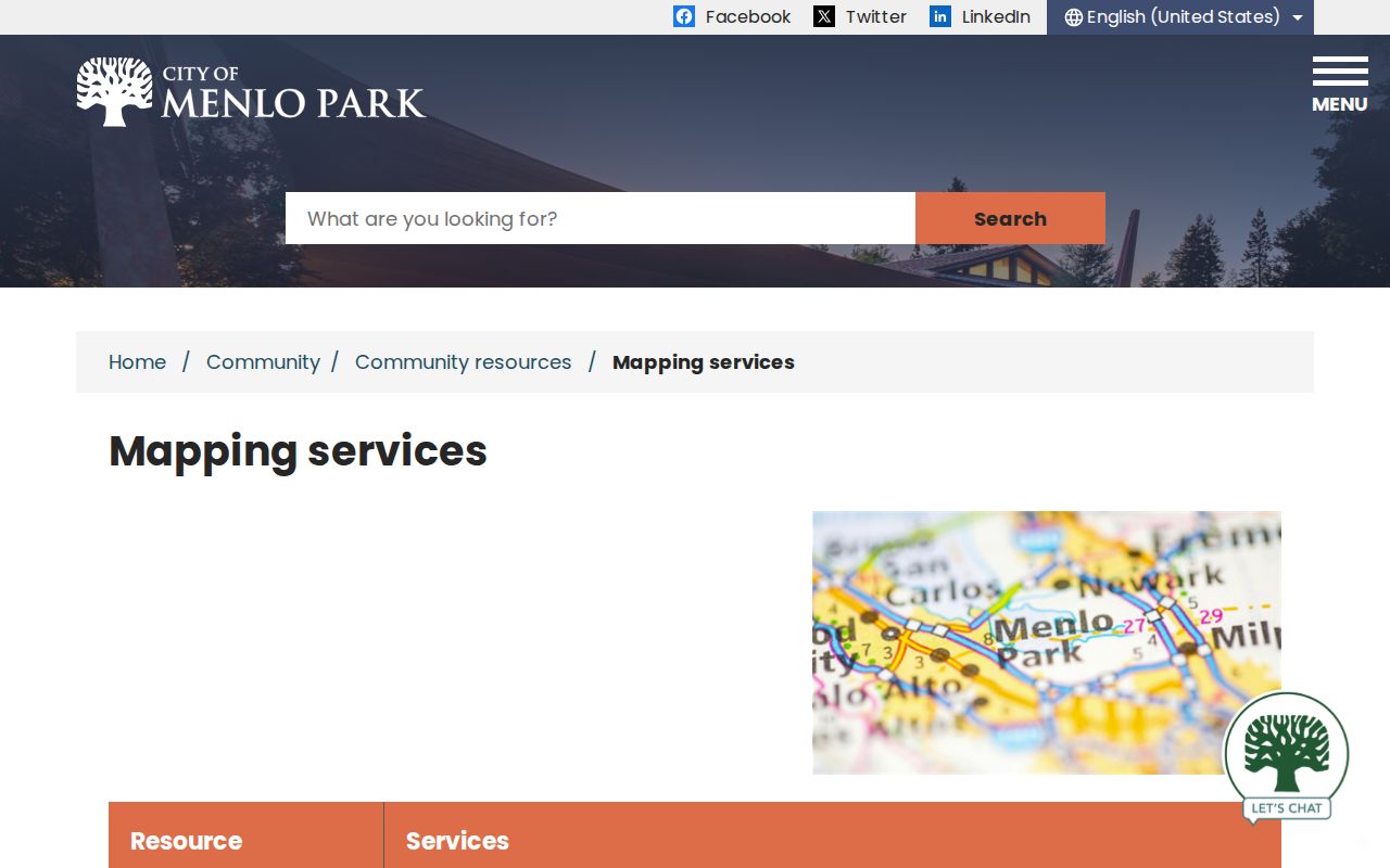
The city GIS image shows why parcel-by-parcel browsing helps: a street can be read as mapped lots before names are sought elsewhere.
Menlo Park Street Directory Parcel Limits
The Menlo Park public parcel layer exposes APN, situs parts, jurisdiction and within-city status, legal description, book/page/block/lot, subdivision data, recording date and document number, last-sale date, zoning, land use, lot area, year built, buildings, units, stories, historic, flood and seismic facts, census geography, districts, and coordinates.
Owner and owner-mailing fields are absent from the inspected layer. That is a web-layer limit, not a broken search. Use ACRE's lawful assessment-roll or counter channel for assessed owner and mailing information, and the recorder for named instrument parties. Identical situs and mailing addresses are clues, not proof of residence.
The Menlo Park public parcel layer schema is the official reference for the fields behind a street query.
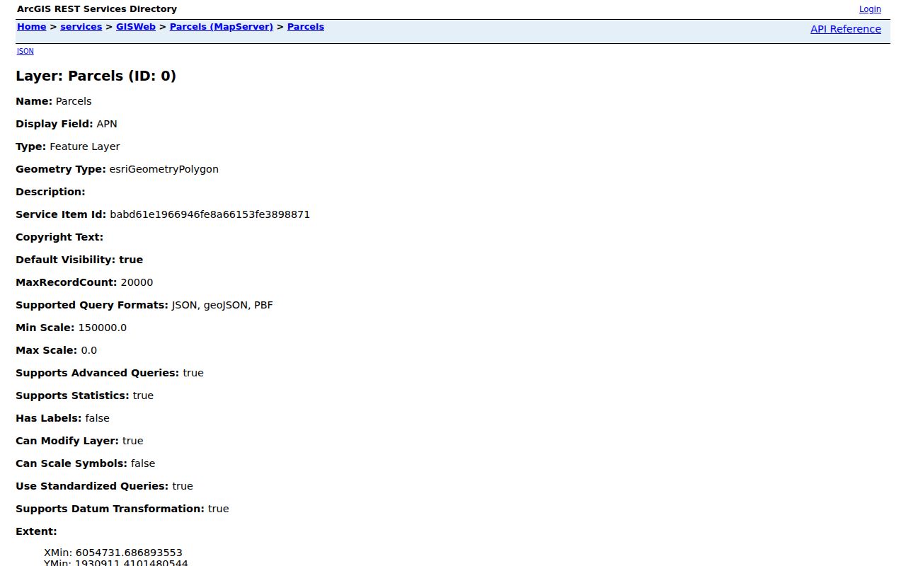
The parcel-layer view is a schema check, not an owner lookup. Its stable fields join maps, permits, and deeds without inventing a resident list.
Menlo Park Street Directory Records
Current address-keyed records divide the work among city, county, and library custodians. The San Mateo County ACRE office combines assessor, recorder, clerk, and elections functions, but its rolls remain separate.
| Record set | Keeper | Street-level use | Access |
|---|---|---|---|
| City GIS parcel layer | Menlo Park GIS | APN, situs, jurisdiction, land and district fields | Free map and REST query |
| Assessor maps and roll | San Mateo County ACRE | Parcel relation, assessed owner, values, exemptions, mailing destination | Online map; roll/counter channel |
| Recorded deeds and liens | Recorder Division | Grantor, grantee, instrument, dates, legal description | Free index; paid image or copy |
| Permit history | Menlo Park Building Division | Applications, contacts, work, inspections and attachments | Accela search; counter or CPRA |
| Voter record | San Mateo County Elections | Self-status or an approved file request | My Election Info; restricted request |
| Reverse directories | Libraries and archives | Dated occupants, addresses and sometimes occupations | Library or in-person collection |
The APN joins the first three rows. A permit is project evidence, not a household roll; a reverse directory is a dated clue, not proof of continued occupancy. A targeted existing-record request is the fallback when a portal is thin.
Keep Menlo Park Street Records Distinct
San Mateo County records use several address ideas at once. Situs is the physical parcel location. Mailing address is where assessment notices go. A plat is a recorded map of lot, block, or subdivision relationships. A criss-cross directory is a dated address-order section that may place occupants beside a house number. None means “everyone who lives there.”
- Parcel
- A mapped assessment unit identified by an APN; it may contain more than one unit or building.
- Situs
- The physical address used to locate the parcel and match a street search.
- Plat
- A recorded map used to read lot, block, subdivision, book, and page relationships.
- Criss-cross directory
- A reverse or street-order directory that can connect a dated address to an occupant entry when the volume includes that section.
An owner may receive notices at another city, trust address, or management address. The inspected web layer does not expose owner-mailing fields, so use the assessment roll and Recorder Division. Keep situs, mailing, APN, and legal description separate.
Trace Menlo Park Title Records
RecorderWorks is free and requires no login, but it is party and document keyed, not a street browser. Search the current grantee, capture the grantor, legal description, APN when shown, date, document number, and book/page, then search the seller as grantee to move backward.
Modes include LAST FIRST name matching with Grantor or Grantee roles, partial matching, document number, book/page, recording date, document type, and parcel number. The index does not establish title or occupancy. Read the image or order a copy when the instrument matters.
Current deeds cost $5 for the first page and $1 for each additional page; certification adds $5, and a conformed copy adds $10. Confirm fees before ordering. Known instruments can be requested by mail with payment and a self-addressed stamped envelope at 555 County Center, Redwood City.
Note: A seller's name is a bridge to the prior deed, not proof that the seller or buyer occupied the parcel.
Menlo Park RecorderWorks Eras
The modern name-search era reaches recorded property documents from 1985 forward. The computer index reaches 1963 forward, but 1963-1984 work may require a document number or recording date. Pre-1963 material moves to Recorder counter microfilm. Before 1980, book and page are the key bridge; from 1980 onward, document numbers are used.
For older households, keep the address, APN, subdivision, lot or block, and book/page together. A changed number can hide the same parcel. Counter books, microfilm, and a mailed request for a known instrument fill the early-record gap.
Menlo Park Accela Permit Records
The Menlo Park Building Division routes public permit-history work through Accela. Its General Search supports record number, record type, project name, start and end dates, street number, direction, street name, street type, unit, APN, first name, last name, business name, and license number. Search Applications is public; creating or submitting an application requires registration.
The Menlo Park Building Division page is the official source for permit-history and records-copy services.
The Building Division page connects a street search to the city record custodian. The image belongs with permit-history work, where an address can be tied to a project rather than mistaken for a resident roll.
Permit records may show a property owner as applicant, contractor, project contact, scope, status, dates, and attachments. Menlo Park launched Accela in November 2019 after replacing Tidemark; older files may need staff help. If results are thin, use the city public-records route for existing records tied to the address and a narrow date range.
Menlo Park Street Address Bridge
When an old directory, deed, and permit use different numbers, the city address-change file is the cleanest bridge. The owner submits a signed request and site plan; the Building Official checks the street sequence, then Police and the Menlo Park Fire Protection District review it. The stated fee is $129.
Request the approval file by parcel or address and place its date beside deed and permit dates. It connects old and new numbers without guessing, and helps choose the city or county custodian.
Menlo Park Street ZIP Boundaries
ZIP geography can send a street search to the wrong office. ZIP 94025 covers incorporated Menlo Park areas and adjoining unincorporated postal territory. West Menlo Park, Menlo Oaks, and North Fair Oaks may carry a Menlo Park label while remaining under San Mateo County jurisdiction. Check the city GIS boundary and county Property Information Portal before choosing a permit custodian.
ZIP 94026 is a Menlo Park post-office-box ZIP; 94027 is Atherton; 94028 is Portola Valley and nearby unincorporated territory. The USPS ZIP lookup verifies delivery geography, not city limits. Use situs, APN, jurisdiction, and permit instructions together.
Menlo Park Street Directory Reverse Leads
Verified years are uneven. Research identifies a 1922 regional volume, a 1929-1931 Palo Alto-cataloged run that includes Menlo Park, and Menlo Park city directories from 1978-1980 at the San José Public Library California Room. The exact publisher and a complete local reverse run remain unverified.
Check the Menlo Park Historical Association archives, library shelves, and NARA's 1929-1931 city-directory listing. Search title geography, not only “Menlo Park.” The Menlo Park city directory collections page keeps historical shelves separate from the modern address chain.
A reverse entry may show an occupant, address, occupation, spouse notation, or an ownership mark. Absence is not proof of departure. Pair each entry with a date and another record, and record gaps rather than guessing.
Menlo Park Voter Lookup Limits
San Mateo County's My Election Info is a self-lookup. It asks for house number, five-digit ZIP, and birth date, then can return status, party, precinct, districts, and election information. It does not accept a street name to produce a neighbor list.
California Elections Code section 2194 restricts voter-file use, while Government Code section 7924.000 protects home address, telephone, email, and precinct details except through authorized access. A specific voter is an identified person, not everyone on one street. An approved full-file request may be sorted geographically only for an authorized purpose and under the required application and security rules.
A voter match supports the identified person's self-verification; it cannot become an ordinary public street roll.
Menlo Park Street Directory Privacy Limits
Public address records do not expose every household member. A deed names instrument parties, not children or other occupants. A permit names project participants, not everyone in a building. Utility customers, DMV addresses, Safe at Home participants, protected voters, and sealed matters may not appear.
Lawful use. Use Menlo Park parcel, deed, permit, and directory records for personal research, family history, civic questions, or scam checks. Do not use address information to stalk, harass, threaten, intimidate, or harm anyone.
California's Safe at Home program can provide a substitute address and mail forwarding for eligible participants; it does not automatically erase older records. When a record is missing, use the counter, library, microfilm, or targeted request route.